 I’ve spent a considerable amount of time surveying since I've been in the golf business. Initially I helped clubs, architects and a developer with GPS surveying. The hand held device is a sub-meter system and the errors are quite small. I used it as a construction/staking tool to help determine where to cut & fill, planned irrigation or drainage locations and keeping track of teeing areas – they are mostly invisible out here, so they are easy to lose.
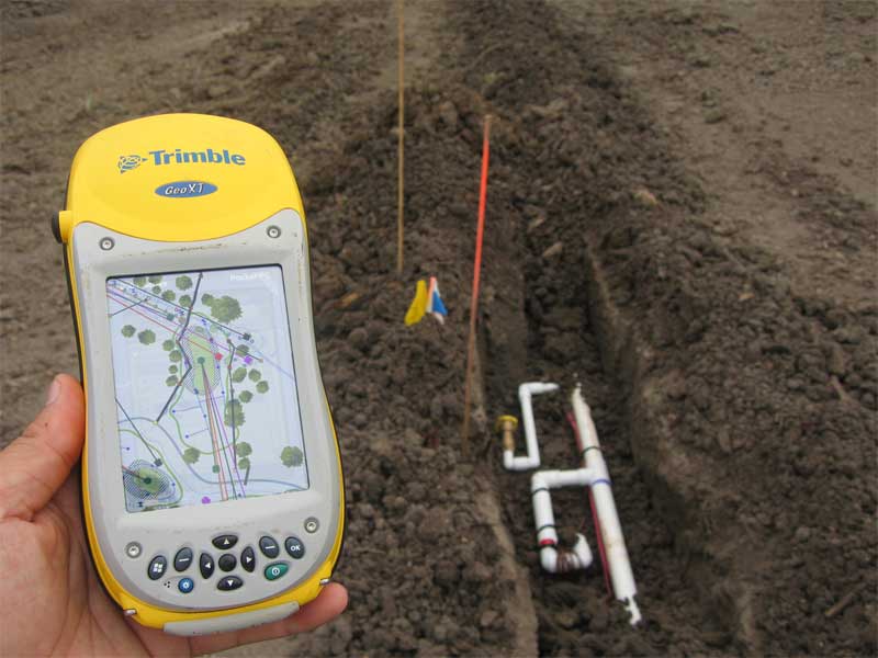
 In the picture shown above I am recording where the irrigation was installed. That is a swing joint for a valve in head rotor and a quick coupler near the 15th green. As I am often on site it is much easier to record while the trenches are visible. Any future superintendent will have a very accurate survey of the heads and basins, including all the drainage and irrigation pipe locations – that is rare from my experiences. Often a survey is taken after the course is completed and put together with field notes.
We are presently transferring the data to a hand held computer to help run the irrigation system from the field.


No comments:
Post a Comment
Submit a comment and I'll make sure it isn't spam and post it asap. Thank you.