Showing posts with label GPS. Show all posts

Tuesday, January 18, 2011

A couple of media mentions

Last week Nuzzo Course Design was mentioned in a couple places:

I was asked to be a judge for Golf Inc Magazine's annual development of the year awards.
Some were nice, but most were still overdone.  Some of the best golf courses in the world have been built on practical budgets.  I don't think many developments are marketing to players.  Pretty pictures will bring someone down once.  The golf course had better be really good if you want them to come back.

Here are a few of my comments about the nominations:
  • At that price I’m not sure how the mission could be achieved. The ride from 9 to 10 is one of the longest I have ever seen. Too much water for the public golfer to enjoy regularly.
  • Too much water, way spread out, over done bunkering.
  • Does not blend seamlessly into the native environment – not even close. Lots of water and 11 parallel hole corridors – 8 of them side by side.
  • The routing appears a bit disjointed with some large separations between holes. Some of the shaping and features are overdone, and some of the bunkering looks really good and original.
  • Nice to see non-returning 9s, fewer restraints usually leads to a better course.
  • Some pictures show good restraint and very nice golf holes, others seem to shout look at me.
  • Would have done better with fewer and less busy looking bunkers.
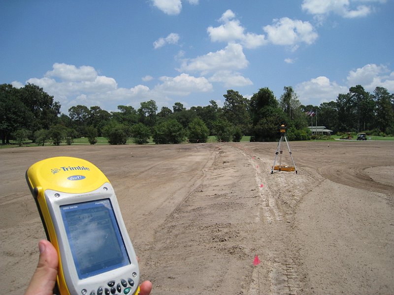
There was also a brief mention of some of my work at Champions Golf Club in Golf Course Industry Magazine.  The picture above is during the range renovation at Champions.  In the foreground is a sub-meter GPS measuring device.  I can map my designs on to the ground and record what happens in the field as we go - to make sure the irrigation is efficient and in this case to get the tee line oriented perfectly.  In the background a laser is used to measure the finish work and helps keep the tee perfectly on plane.

Tuesday, January 13, 2009

173 Tees


I recently finished GPS mapping all of the grassing areas and features - greens, fairways & tees. When Don and I play a round the winner of the hole chooses where to tee from - usually very close to where we sank our putts. I did win our last match 2&1, but more about that another day.

The philosophy of the courses tees was to have as many different interesting locations to start a hole from, and it only needed to be a small flat spot. They don't look like tees - they aren't raised above the ground like the things elephants stand on at the circus.

It turns out there are 173 big, little, funky, cool spots to start playing from.  The main clubhouse is surrounded by tees as represented by the green circles in the above illustration of the GPS'd data.  Many of which can be used as tees for either the 1st or 9th hole - depending on your mood, your game and your opponents game.

Different winds and different tees combine for unique angles and strategies every day.

Monday, January 5, 2009

GPS: I'm like a giant pencil


Last week I started GPS mapping the final details of Wolf Point.  Fairways, greens, tees, alternate tee locations, bunkers and anything of interest.  The irrigation system is already completely mapped and hasn't changed.

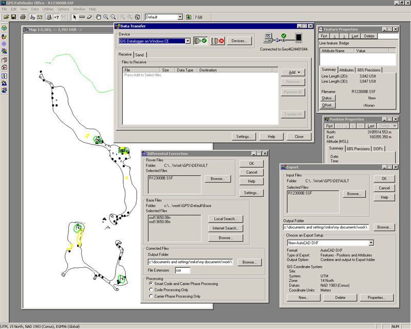
The above image is a screen shot of some of the steps to get the data to a final image like the irrigation as-built.  The hand held unit communicates with the GPS satellites and records my movements.  Picture me as a giant pencil drawing points, lines or shapes.  Where ever I go I can record.

Finding all the potential tees is the most challenging part of this exercise, there are a lot of them - note all the dots in the above image.  And the nice weather is a draw away from the work.  Don and I played a match in the afternoon.  I'll share some of the surprising spots he wound up later this week.  I played easily with a single ball - I'll break 80 at Wolf Point one day soon - I did birdie 12 - not easy to do.

Happy New Year.

Tuesday, February 5, 2008

Some examples of iterations - 14th Fairway


Last week I showed an image of several iterations of the course. I'm going to further explain how the process of acquiring field data and design evolution worked together. The above flash images show part of the evolution of the 14th fairway.

The first of 3 images show green highlighting - which is the planned clearing. Originally I was trying to find the best angle into the green that crossed the creek. There were two very nice live oaks that surrounded the eventual creek opening. I had to select which tree to have removed.

During the clearing Don and I found that there was an even nicer tree near the 2nd landing area - it is a par 5. So now the question was which side of the tree to go around. Between our time on site and updating the GPS and construction files it was easy to see the impacts of our decision. We decided to leave the tree - figuring we could always take it down if the hole wasn't better strategically.

The third and final image shows how we incorporated the tree into the irrigation plans. The tree location was brought back into the construction documents and the irrigation plan was modified. Note we also didn't build a few bunkers as the strategy of the tree and the shaping of the fairway created enough strategy to make 14 a very fine hole.

Monday, January 21, 2008

Iterations every visit

How effective can the design evolution and construction process be chronicled and how iterative should they be as processes?

Typically when a course is built to print, or by what the plans say, the builder follows the plans and the architect visits to make sure everything is going according to that plan. If there are any problems they adapt and find a solution. If something isn't turning out quite right, they modify the construction. There are many projects that have been built and will be built where the design is modified significantly in the field - after it has been finished and even irrigated at considerable wasted expense!

Throughout the design and construction of Wolf Point I would bring the GPS unit on site integrated with the latest plan - so when I walked around I could see where I was relative to the as yet unbuilt golf course. We used the tool to assist us with layout, clearing, earthwork, shaping, drainage, irrigation, feature construction and grassing. At each stage and with each visit I would map any new features (a nice live oak we saved) or changes we made in the field into the GPS unit and incorporate those into the construction documents. I'd study them in the office and often make additional adjustments to subsequent stages - like irrigation. I would then incorporate those adjustments into the GPS unit for the next site visit. So each and every visit would entail an iteration of incorporating planned changes and then recording any field changes -- over and over again until we were finished.

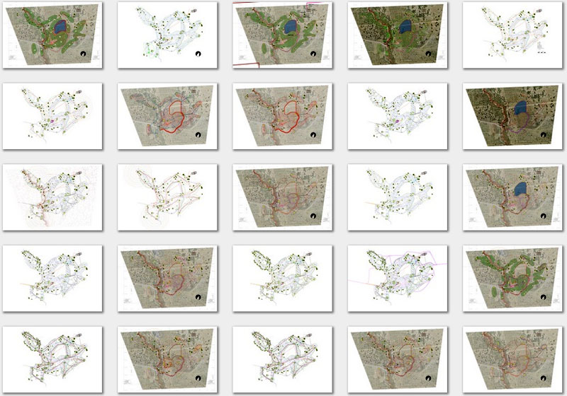
The image above is about half of the image layouts that were used during construction of various stages. It is one way I have a record of the process through the many snapshots of the GPS images.

Here was the Turfnet Article that described the process from a broader perspective.

Tuesday, November 13, 2007

Turfnet: The Newsletter


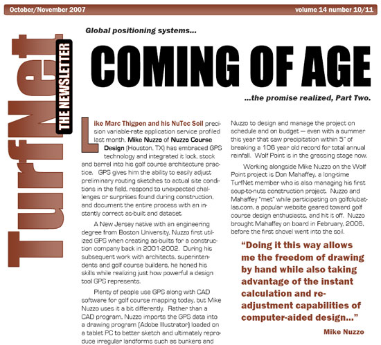
Recently Don and I were interviewed for an article in Turfnet: The Newsletter. The story was based on our use of GPS at our project. Please click if you'd like to read.

Wednesday, July 11, 2007

Irrigation As Built

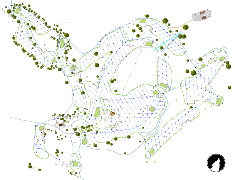
The above illustration the irrigation system in its entirety - almost. All the data has been collected in the field using the GPS unit from yesterday’s image. The data has been post processed – [the unit collects data from several satellites as items are measured. Afterwards data can also be collected from a regional data collector to further refine the errors. The geometry of the satellites has a big part of the accuracy and using a regional beacon adds to the accuracy.]

I then compile the new measurements – recording during construction requires many individual days of measurement – to the image you see above.

There are a few more heads still out there, but thankfully not many.

Monday, July 9, 2007

GPS for golf construction

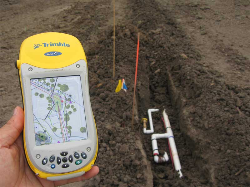
I’ve spent a considerable amount of time surveying since I've been in the golf business. Initially I helped clubs, architects and a developer with GPS surveying. The hand held device is a sub-meter system and the errors are quite small. I used it as a construction/staking tool to help determine where to cut & fill, planned irrigation or drainage locations and keeping track of teeing areas – they are mostly invisible out here, so they are easy to lose.

In the picture shown above I am recording where the irrigation was installed. That is a swing joint for a valve in head rotor and a quick coupler near the 15th green. As I am often on site it is much easier to record while the trenches are visible. Any future superintendent will have a very accurate survey of the heads and basins, including all the drainage and irrigation pipe locations – that is rare from my experiences. Often a survey is taken after the course is completed and put together with field notes.

We are presently transferring the data to a hand held computer to help run the irrigation system from the field.
Related Posts Plugin for WordPress, Blogger...