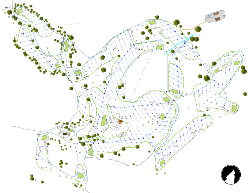
 The above illustration the irrigation system in its entirety - almost. All the data has been collected in the field using the GPS unit from yesterday’s image. The data has been post processed – [the unit collects data from several satellites as items are measured. Afterwards data can also be collected from a regional data collector to further refine the errors. The geometry of the satellites has a big part of the accuracy and using a regional beacon adds to the accuracy.]
 I then compile the new measurements – recording during construction requires many individual days of measurement – to the image you see above.
There are a few more heads still out there, but thankfully not many.
No comments:
Post a Comment
Submit a comment and I'll make sure it isn't spam and post it asap. Thank you.