Last week I started GPS mapping the final details of Wolf Point. Fairways, greens, tees, alternate tee locations, bunkers and anything of interest. The irrigation system is already completely mapped and hasn't changed.
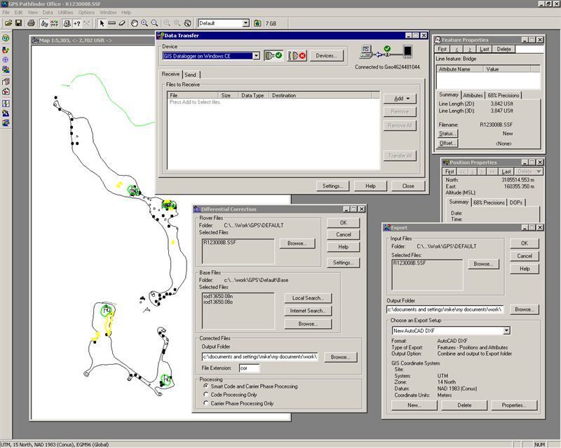
The above image is a screen shot of some of the steps to get the data to a final image like the irrigation as-built. The hand held unit communicates with the GPS satellites and records my movements. Picture me as a giant pencil drawing points, lines or shapes. Where ever I go I can record.
Finding all the potential tees is the most challenging part of this exercise, there are a lot of them - note all the dots in the above image. And the nice weather is a draw away from the work. Don and I played a match in the afternoon. I'll share some of the surprising spots he wound up later this week. I played easily with a single ball - I'll break 80 at Wolf Point one day soon - I did birdie 12 - not easy to do.
Happy New Year.
No comments:
Post a Comment
Submit a comment and I'll make sure it isn't spam and post it asap. Thank you.