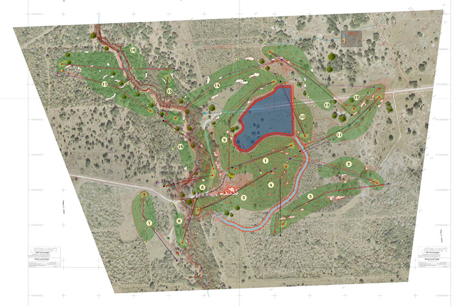
The first difference I notice with this routing plan (#9 which is about 2+ months in) from routing plan #6 is that I'm working with a new aerial photo and topographic map. The site was flown and the stero photographs were compiled into a 1' contour map. Having this detial alows for more efficient planning of drainage, irrigation and earthwork. It is a necessity. Another addition is I've located some specimen trees via GPS - I walk around the site mapping interesting features - drainage swales, green locations and nice trees. This is also about the time where I started walking the site with the above plan incorporated into the GPS receiver - so as I always know where I am relative to the yet to be built golf holes. I can stand on the planned 5th green location before we start - and make any adjustments or keep it as planned.
The maintenance facility is also more refined - Don Mahaffey was definately involved at this point prior to moving down to Texas. The location for the facility was close enough and also had two major benefits - hidden from the course and has good access from the road. It was a natural clearing just the right size - so we also didn't have to clear at all.
Another refinement was the finalization of the access road and the main clubhouse. In version 6 the clubhouse is closer to the lake - which was more in line with the building architects original plans - more on a bluff. With the 2 options in hand our client chose what I now consider to be the best option. The four holes surrounding the clubhouse have conjoined even more than before and form one of the biggest lawns I've ever seen.
The 7th hole was also shifted to allow the current road to provide access. This would also create an entrance road that winds surreptitiously around the property before entering in the back of the golf course - it creates a very cool reveal - which is a foreshadowing for the reveal when you travel through the clubhouse to the above mentioned view.
The 9th and 14th fairways have also started to touch - they will do more so as we evolve. With more time on site the strategy of the 5th hole can be accomplished without any green side bunkers - the green site is surrounded by natural drainage swales - these land forms would be used as a style for areas that needed to be created.
I have lots of great new pictures from my last two visits and also a couple more birdies to talk about - there are 2 more holes in play.
The the next several posts I'll continue to discuss the evolution of the routing plan at Wolf Point Club as recently published in Paul Daley's new Golf Architecture - A Worldwide Perspective.
No comments:
Post a Comment
Submit a comment and I'll make sure it isn't spam and post it asap. Thank you.