 I am visiting a new client this week. The project is to rebuild a green complex later this year, and look at some tee options. The course is 60 years old and has several different styles throughout.
 Prior to my visit I was able to compile a Google aerial image and recreate all of the golf features - greens, tees, bunkers, ponds & fairway. This is probably the most accurate set of feature areas in the courses history. I can now easily calculate the square footage of each green, tee, bunker...
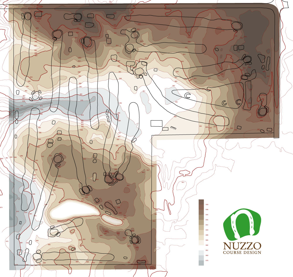
The superintendent also shared an available county topographic website, which I was also able to compile and chart. Above is the illustration I can bring to my first site visit to begin working on a specific problem and also start to work on a long term master improvement plan.
Every piece of information is now in one file and I will make any site visit notations or future design changes in this same file as well - everything will always stay associative. Drainage, irrigation, earthwork, cart path or anything mapped via GPS.
As for the topo, the darker the brown the higher the elevation, the darker the grey, the lower. It is now easy to spot the valley along with the high and low spots throughout the course.
Research, facts and preparedness makes for a much easier site visit and better results.
No comments:
Post a Comment
Submit a comment and I'll make sure it isn't spam and post it asap. Thank you.