The first time Google earth had captured our work at Wolf Point I was alerted by our crack inspector - my father - who was just as excited to see it from above as I. It was under construction in the satellite image and it showed the different stages of construction.
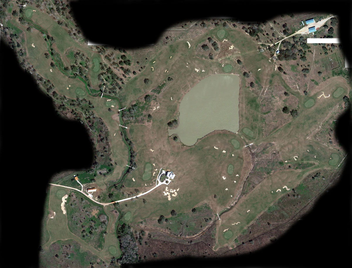
Recently I checked and found the 3rd iteration of the golf course aerial - see above. This one is recent. I'll need Don to accurately add a date. The course is more mature and grown-in (often it takes a few years).
What pops out for me? The areas that we hardly disturbed look easier to maintain, but those are also the areas along the creek - where water naturally heads anyway.
The file I compiled from Google is very large, large enough so show detailed areas and holes in the coming weeks or months.
Can you see the routing - or identify all the holes? Hint: Start from the building in the middle.
Cheers